
Google tells the distance between two points if you are looking for directions between two fixed points. However, if you want to know the distance between points like point A and point B, use Google’s free point distance measuring feature.
You can use this feature on Web interface on a computer and on the mobile application.
We will show you how you can measure the distance between two points using Google maps.
Use Web browser to measure distance.
- Using any browser visit maps.google.com

- Now right-click on the starting point from where you want to measure the distance. Then choose “Measure Distance”.
- Now to follow the path correctly click on every curve and make sure you are clicking on the map regularly to get accurate results.

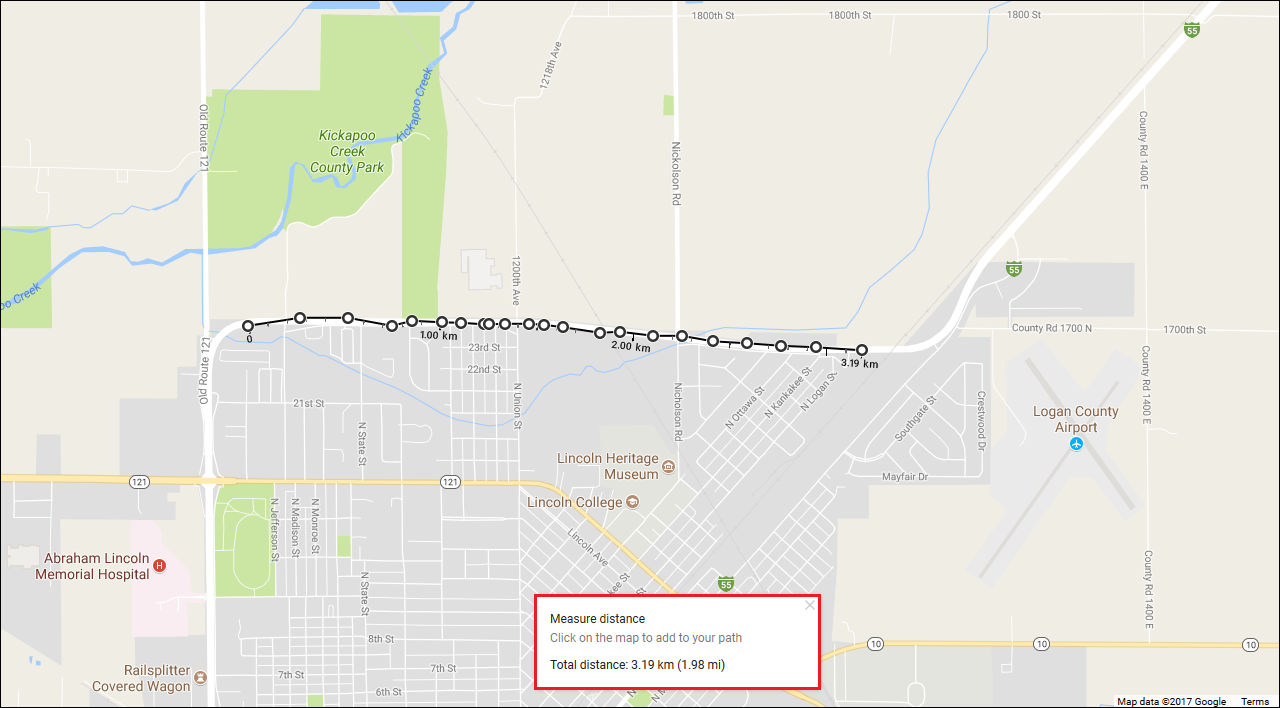
You will see total distance at the bottom of the Map.
Note: In order to be more accurate, you can zoom in and out as much as you like.
To make a complete circuit click on the starting point you made.
Note: if you are making a complete circuit you will also be able to see the total of the area.

Once the path is selected and you have selected all the points, you can also delete a point, to do so simply just click on it.
You can also add points anywhere along the line and you can also drag them to change the path.
Use mobile application to measure distance.
- Open google maps on your phone.
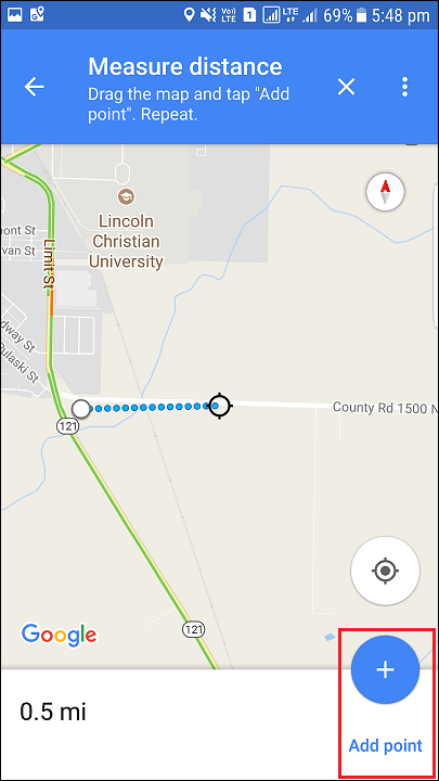
- Long press the point on the screen from where you want to measure the distance. Then click on MORE INFO.
- After clicking on MORE INFO choose Measure Distance.
- When you click on Measure Distance, you will see a floating cursor. To add a point, click on Add point button located at the bottom-right corner of the screen.
- Now to follow the path accurately as you have done in web browser click on every curve and make sure you are adding extra points on the map in shortest distance to get accurate results.


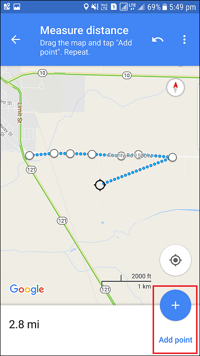
Note: You can also zoom in and out as you have done in web browser to be more accurate
Note: You will see total distance at the bottom of the Map.

Although, Google Maps directly provides you the distance between to fixed points. You can use the free point distance measuring technique to measure distance between any point on the map. This feature will be helpful for the users who are hiking and on a trip where there is no fixed point.


Leave a Reply